Lacey, WA
We have had more sunny days and more heat than I can ever remember. Today is suppose to get in the low 90's. That is really hot for the Seattle area and with all the lakes, rivers and of course the Puget Sound it gets a bit humid, we are not use to this.
This will be the perfect day to go to the mountains to cool off. We have not been to Mount St. Helens since 1989, nine years after the eruption. At that time we lived in Northern California and we were camped at Dillon Beach, just north of Point Reyes National Seashore. Most people in the Pacific Northwest know exactly where they were and what they were doing that Sunday morning.
A quote from the pamphlet: "On Sunday morning May 18, 1980, the power of nature came to life as Mount St. Helens erupted, causing the largest landslide in recorded history. Wind, fire, heat and debris swept down the Toutle River Valley and left a barren, gray landscape behind. Today, the gray is turning to green, bright flowers are taking their place amongst ash and mud and seedlings are reaching up from the bottom of barren trees".
A quote from the pamphlet: "On Sunday morning May 18, 1980, the power of nature came to life as Mount St. Helens erupted, causing the largest landslide in recorded history. Wind, fire, heat and debris swept down the Toutle River Valley and left a barren, gray landscape behind. Today, the gray is turning to green, bright flowers are taking their place amongst ash and mud and seedlings are reaching up from the bottom of barren trees".
Mount St. Helens is only about 85 miles from our house, mostly through beautiful winding mountain roads. Our destination was Johnson Ridge Observatory. I'm not sure when they built the road to this lookout but I know it was not here in 1989.
On this route, Hwy 504 off of I-5, there are four visitor centers each one has it's own unique perspective and history lesson. If you go be sure to plan ahead, there are many hiking trails at each visitor center, this is an all day trip so take your lunch. For more information: www.visitmtsthelens.com, www.fs.usda.gov/mountsthelens, http://vulcan.wr.usgs.gov/Volcanoes/MSH/


I hope you can click on these picture to enlarge them, if not let me know and I will change them to larger.
That's about it. A very informative trip and wish we had gone sooner which is just a reminder to see what is in your own backyard.
Safe travels to all, thanks for stopping by.
Joe and Nancy
On this route, Hwy 504 off of I-5, there are four visitor centers each one has it's own unique perspective and history lesson. If you go be sure to plan ahead, there are many hiking trails at each visitor center, this is an all day trip so take your lunch. For more information: www.visitmtsthelens.com, www.fs.usda.gov/mountsthelens, http://vulcan.wr.usgs.gov/Volcanoes/MSH/
Inside the first visitor center. timed pictures of eruption, the time is in the lower left corner


This person is at the top of Mount Adams. I bet that was scary


Unfortunately there was a haze in the air so none of the pictures are real clear
Toutle River and valley


Herd of elk crossing the river kind of fuzzy, they were a long way off,
I'm surprised it came out this good after I cropped it.

Looks like smoke but is actually dust. This is a very large steep canyon and rocks and debris are constantly tumbling down into the canyon leaving almost constant dust in the air.

The mountain which is now only 8,365 feet.
Not sure what the peak was before the eruption

View from one of the hiking trails


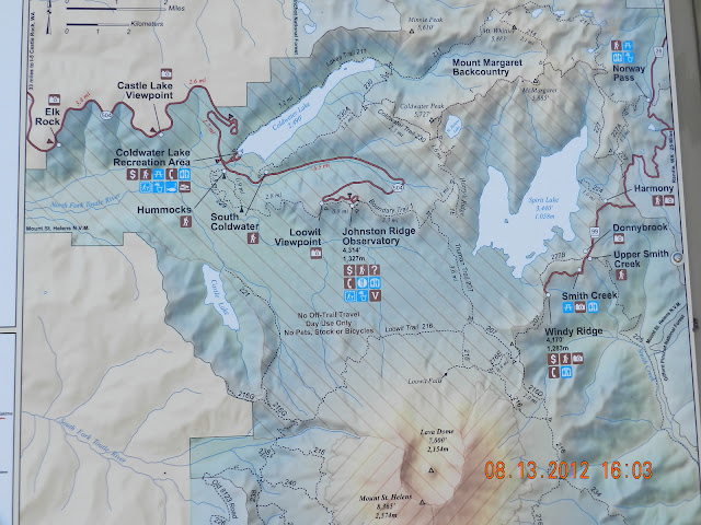
picture of map where we drove to


These signs had to be taken in two pictures


Great displays in every visitor center

I hope you can click on these picture to enlarge them, if not let me know and I will change them to larger.
That's about it. A very informative trip and wish we had gone sooner which is just a reminder to see what is in your own backyard.
Safe travels to all, thanks for stopping by.
Joe and Nancy
hey, thanks to you today, for this post! We are heading for Mt. St. Helens in about 15 minutes. Haven't been there in YEARS, so really looking forward to it! Will post pictures later.
ReplyDeleteBetty from Milwaukie, Oregon
Thanks for the post. It is fascinating. I have a friend who lives in Vancouver, WA. I remember her telling a little of what the eruption was like.
ReplyDelete